One planet, settled at one coast
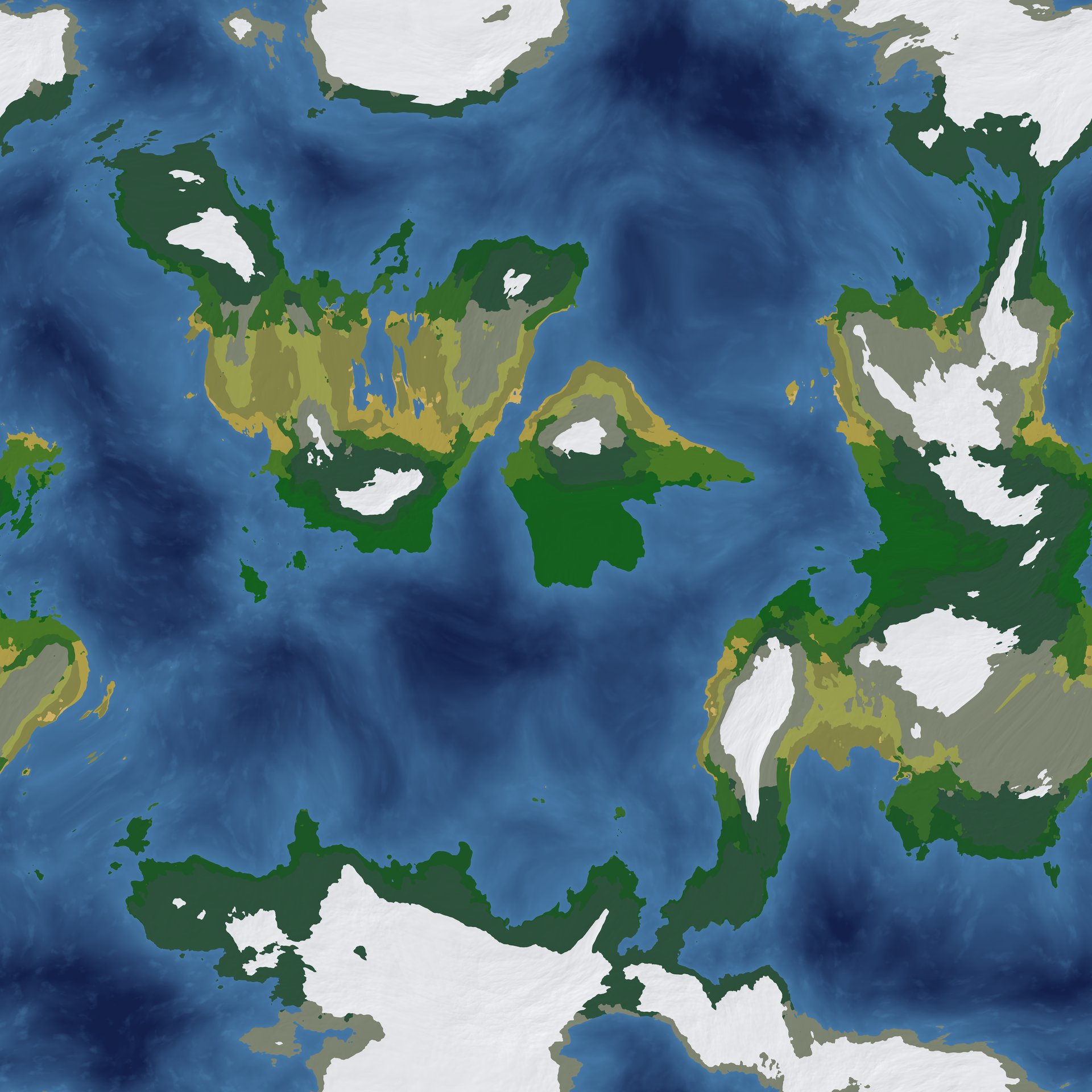
Tirawen is one planet, shaped like a torus. Both axes wrap, so there is no edge and no pole. Walk north long enough and you come back from the south. Sail east far enough and your own coastline rises on the horizon. About 6,150 km per side, roughly the surface area of the Moon.
Three continents sit in one connected ocean, with 83 islands and 148 smaller islets scattered between them. The ocean is wide on purpose. Crossing it is a real trip, which is the whole reason to build a boat and learn to read the water.
You start at Ent'Lynthis, a feudal town on a mediterranean coast, the one built city on the planet. Step past its walls and the rest is unsettled. The other continents and every island out there are frontier nobody has claimed. Two moons cross the sky; on clear nights the dark one drags a black spot across the bright one.
Stand on the dock at dawn and the map is yours to fill in. Pick a direction. The far shore is out there whether or not anyone has named it.
Both axes wrap. Walk far enough in a straight line and you arrive behind yourself.
The planet is one deterministic torus. There is no stored heightmap of the whole world; the surface is computed from position. A macro field fixes the large-scale shape (continents, coastlines, mountain belts, climate, biomes), and a bounded detail layer adds sub-cell texture on top. The detail can perturb the ground but cannot cross a macro boundary, so the coast you walk is the coast the globe shows.
The detail amplitude tapers to zero as the macro elevation approaches sea level. That makes land and ocean consistency structural, not statistical: the code does not permit a coastline flip. The same generate(seed, x, y, z) runs on client and server, built on an integer-hash noise instead of a platform-varying float library, so every machine produces byte-identical terrain.
Ent'Lynthis is an authored layer over the procedural ground. A pass over the baked macro picks the site (best temperate coast); the town itself streams as edit deltas over the deterministic baseline, the same path any player edit takes. Where the capital sits is generated. What is built there is authored.
- About 6,150 km per axis, both wrapping; surface area roughly 37.9M km², Moon scale.
- 3 continents, 83 islands, 148 islets, one connected ocean; counts are generated ground truth from world_meta.json.
- Sea level is y = 0: land above, sea floor below, no separate water-plane primitive. Two moons.
- Macro shape plus bounded detail; one generator on client and server, parity-gated in CI (zero land/ocean flips, zero cross-machine mismatches over 3M samples).
- The capital is an authored edit delta on top of the procedural terrain, not a hand-built map.